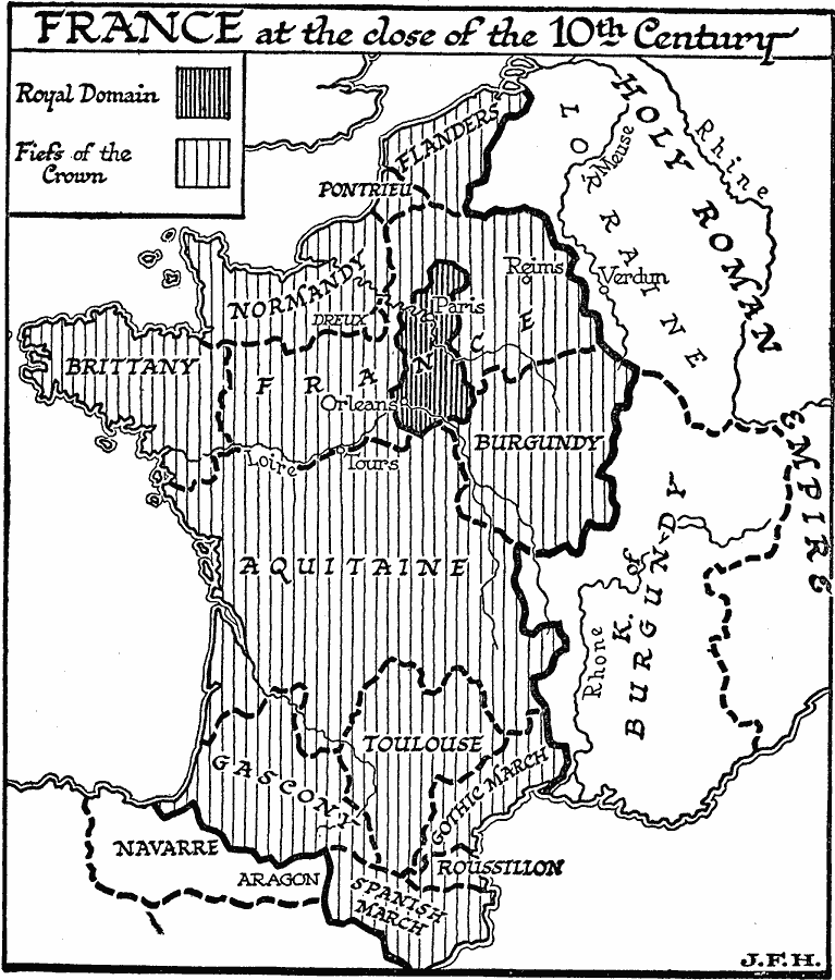
Description: A map of France at the close of the 10th century, showing the Royal Domain around Paris, the Fiefs of the Crown, including Flanders, Pontrieu, Normandy, Brittany, France, Burgundy, Aquitaine, Toulouse, Gascony, Gothic March, Roussillion, and Spanish March, and the territories of Navarre–Aragon, Kingdom of Burgundy, and the western border of the Holy Roman Empire, including Lorraine.
Place Names: France, Orleans, �Paris, �Reims, �Tour
ISO Topic Categories: inlandWaters,
oceans,
location,
boundaries
Keywords: France at the Close of the 10th Century, physical, �political, physical features, major political subdivisions, inlandWaters,
oceans,
location,
boundaries, Unknown, Circa A.D. 999
Source: H. G. Wells, The Outline of History (New York, NY: The Macmillan Company, 1921) 629
Map Credit: Courtesy the private collection of Roy Winkelman |
|
