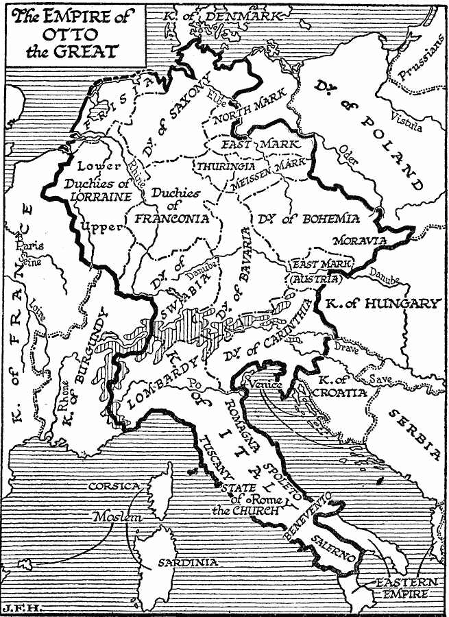
Description: A map of Europe in AD 973 showing the empire of Otto the Great, emperor of the Holy Roman Empire. This map shows German states and duchies, and the Kingdom of Italy of the period, and includes portions of Denmark, Kingdom of France, Kingdom of Burgundy, Duchy of Poland, Kingdom of Hungary, Kingdom of Croatia, the Moslem territories, and the Eastern or Byzantine Empire outside the borders of Otto's Empire.
Place Names: Western and Central Europe, Bohemia, �Saxon, �Italy, �Lombardy, �Swabi
ISO Topic Categories: boundaries,
oceans,
location,
inlandWaters
Keywords: Empire of Otto the Great, physical, �political, physical features, major political subdivisions, boundaries,
oceans,
location,
inlandWaters, Unknown, A.D. 973
Source: H. G. Wells, The Outline of History (New York, NY: The Macmillan Company, 1921) 633
Map Credit: Courtesy the private collection of Roy Winkelman |
|