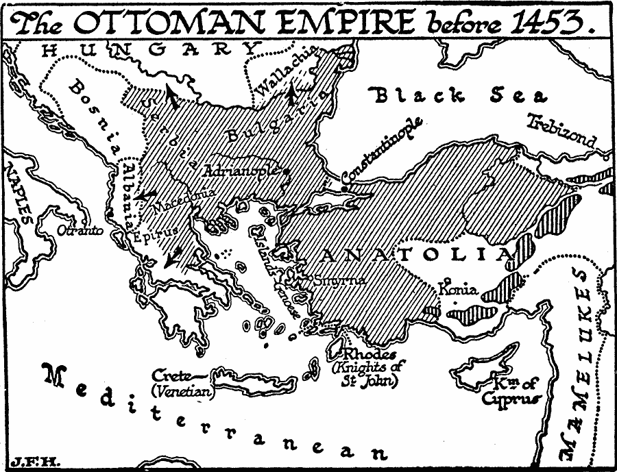
Description: A map of the rise of the Ottoman Empire before 1453 and the fall of Constantinople, showing the territories in northern and western Anatolia, Bulgaria, Serbia, Thrace, Macedonia, and eastern Epirus. The map shows the countries of Albania, Bosnia, and portions of Hungary and Wallachia, the Aegean islands under Genoese control, the island of Crete under Venetian control, Rhodes under the Knights of St. John, the Kingdom of Cyprus, the territories of the Mamelukes, and the cities Constantinople (Byzantine Empire capitol at the time), Otranto, Adrianople (site of the 1365 battle that ended Byzantine power in the Balkans), Konia, and the important trade centers of Smyrna and Trebizond.
Place Names: Regional Mediterranean, Asia, �Europ
ISO Topic Categories: physical, �political, kWorldMedSea, kWorldEurasia
Keywords: Rise of the Ottoman Empire, physical, �political, physical features, major political subdivisions, physical, �political, kWorldMedSea, kWorldEurasia, Unknown, 1453
Source: H. G. Wells, The Outline of History (New York, NY: The Macmillan Company, 1921) 684
Map Credit: Courtesy the private collection of Roy Winkelman |
|
