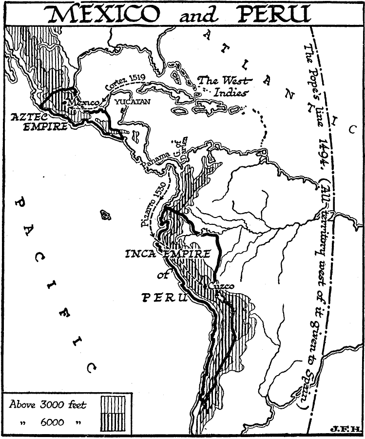
Description: A map of Central and South America showing the extent of the Aztec and Inca empires, and the routes of Hernando Cortez (conquest of the Aztec Empire, 1519) and Francisco Pizarro (conquest of the Inca Empire, 1530). The map shows the "Pope's Line" established by the Treaty of Tordesillas in 1494, which divided the newly discovered lands east of the line to Portugal and west of the line to Spain. The map also shows general elevations to illustrate the difficult terrain of the empires, with elevations over 3,000 feet in light vertical lines, and over 6,000 feet in heavy vertical lines.
Place Names: Regional Americas, North America, �South America, �Aztec Empire, �Inca Empir
ISO Topic Categories: physical, �political, kWorldAmericas
Keywords: Conquest of Mexico and Peru, physical, �political, physical features, physical, �political, kWorldAmericas, Unknown, 1519–1530
Source: H. G. Wells, The Outline of History (New York, NY: The Macmillan Company, 1921) 748
Map Credit: Courtesy the private collection of Roy Winkelman |
|