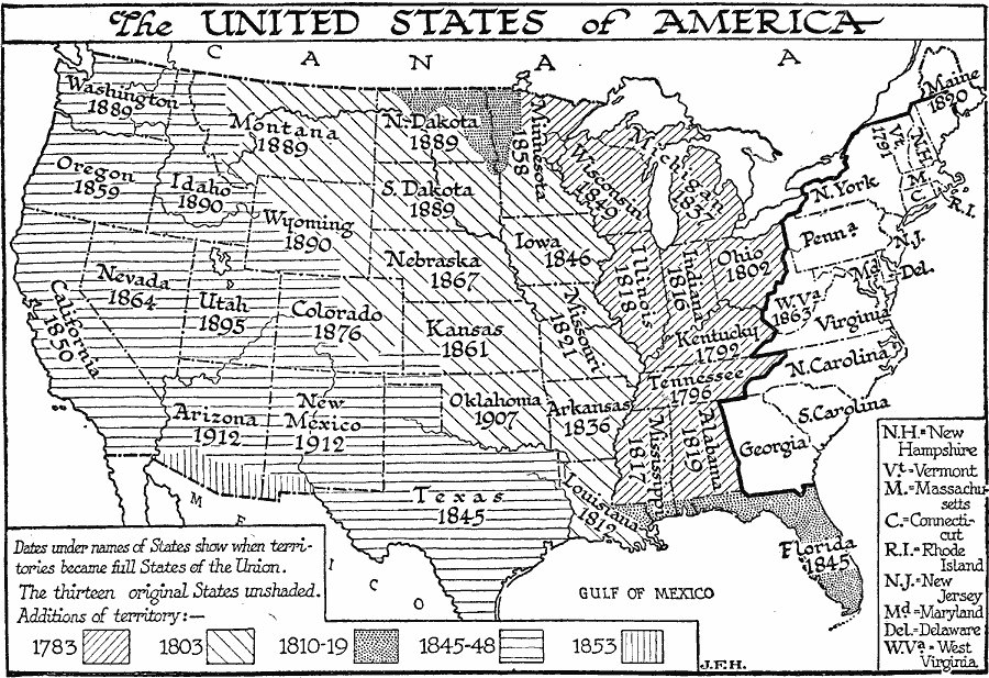
Description: A map of the United States showing the growth of the nation from 1776–1853. This map is coded to show the thirteen original states, and the territories acquired in 1783, by the Louisiana Purchase in 1803, the northern territories, West Florida, and East Florida between 1810 and 1819, the western territories and Texas between 1845 and 1848, and the Gadsden Purchase in 1853. Dates under the States show when the territories became full States of the Union.
Place Names: Growth of Nation,
ISO Topic Categories: boundaries,
location,
oceans,
inlandWaters
Keywords: The United States of America, physical, �political, physical features, major political subdivisions,
country borders, boundaries,
location,
oceans,
inlandWaters, Unknown, 1783–1853
Source: H. G. Wells, The Outline of History (New York, NY: The Macmillan Company, 1921) 845
Map Credit: Courtesy the private collection of Roy Winkelman |
|