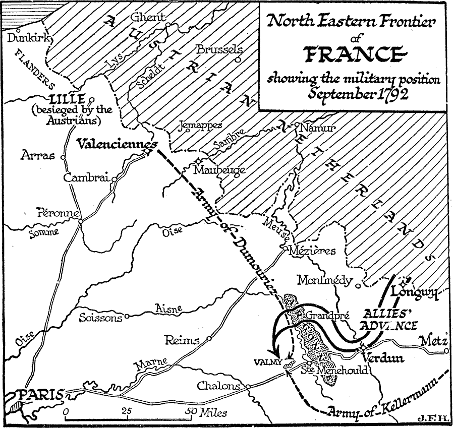
Description: A map of the northeastern frontier of France with the Austrian Netherlands, and the site of the Battle of Valmy during the French Revolutionary Wars, showing the military position in September of 1792. This map shows the French city of Lille under siege by the Austrians, the fallen city of Longwy and the route of the allied forces of Prussia, Austria, Hesse, and Brunswick to Verdun, and Valmy (their intended march to Paris), and the routes of the French Armies under Dumouriez and Kellermann.
Place Names: France, Paris, �Reims, �Arras, �Dunkirk, Valmy, Longwy, Verdun, Argonne Forest, Valenciennes
ISO Topic Categories: intelligenceMilitary,
inlandWaters,
location,
boundaries
Keywords: North Eastern Frontier of France, physical, �political, �transportation, kFrenchRevolution, physical features, country borders, roads, intelligenceMilitary,
inlandWaters,
location,
boundaries, Unknown, 1792
Source: H. G. Wells, The Outline of History (New York, NY: The Macmillan Company, 1921) 874
Map Credit: Courtesy the private collection of Roy Winkelman |
|