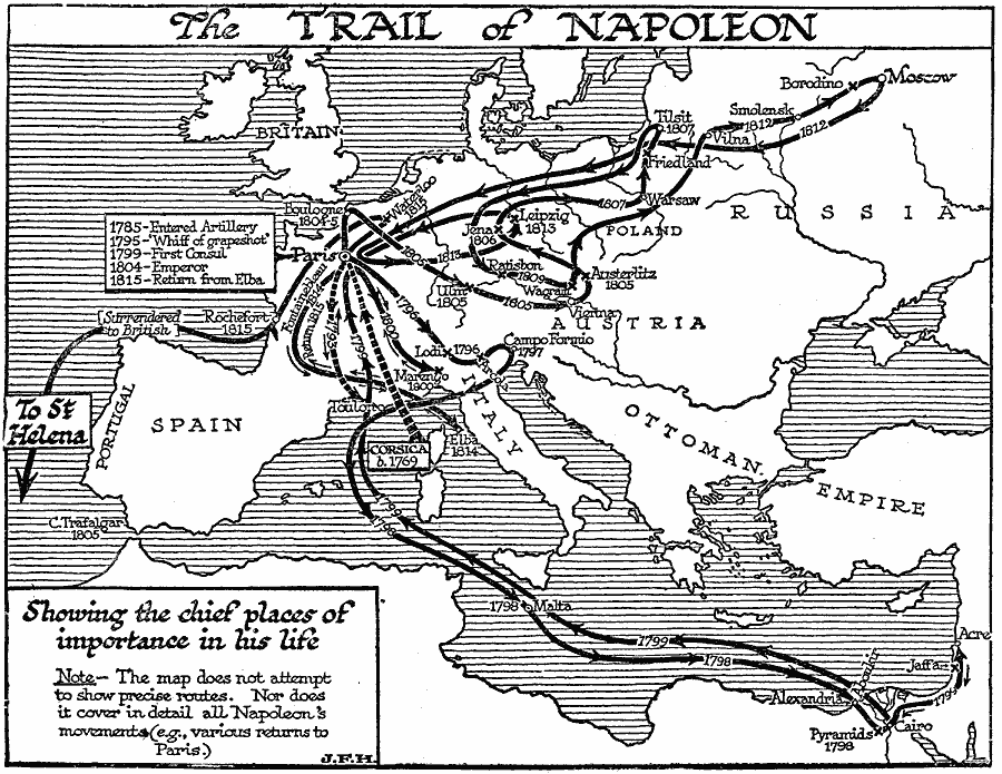
Description: A map of Europe showing the chief places and routes of importance in the life of Napoleon Bonaparte, including his birthplace in Corsica (1769), entered the French Artillery in Paris (1785), 'Whiff of grapeshot' (dispersal of Royalist mob in Paris, 1795),
Siege of Toulon (1793), The First Italian Campaign with the battle sites of Lodi and Arcole, and the Treaty of Campo Formio (1796), The Egyptian Expedition (1798-1799), which included the capture of Malta (1798), the Battle of the Pyramids, Battle of the Nile (naval battle at Aboukir, lost to Horatio Nelson), the Syrian Campaign (1799), and return to Paris, installed himself as First Consul (1799), The Second Italian Campaign and the Battle of Marengo (War of the Second Coalition, 1800), became Emperor of France (1804), War of the Third Coalition (1803-1805), including Bouloone (Boulogne-sur-Mer, 1804-1805), the Ulm Campaign (1805), Britain's victory at the Battle of Trafalgar, Napoleon's victory at the Battle of Austerlitz, the War of the Fourth Coalition (1806-1807), including the Battle of Jena (1806), Battle of Friedland (1807) and the Treaty of Tilsit, the War of the Fifth Coalition (1809), including the Battle of Ratisbon (Regensburg), and Battle of Wagram (1809), the invasion of Russia (1812), including the Battle of Smolensk and the Battle of Borodino, and retreat from Moscow, the War of the Sixth Coalition (1812-1814), including Napoleon's defeat at the Battle of Leipzig, his surrender and abdication under the Treaty of Fontainebleau and exile to the Mediterranean island of Elbe (1814), his return to Paris for his Hundred Days rule, the Battle of Waterloo, final surrender at Rochefort (Roquefort), and exile to St. Helena (1815).
Place Names: Western and Central Europe, Spain, �Portugal, �Italy, �Austria, �Russia, �Ottoman Empir
ISO Topic Categories: intelligenceMilitary,
inlandWaters,
location,
oceans
Keywords: The Trail of Napoleon, political, �physical, �transportation, kNapoleonBonaparte, kNapoleonicWars, physical features, major political subdivisions, water routes, intelligenceMilitary,
inlandWaters,
location,
oceans, Unknown, 1810
Source: H. G. Wells, The Outline of History (New York, NY: The Macmillan Company, 1921) 912
Map Credit: Courtesy the private collection of Roy Winkelman |
|