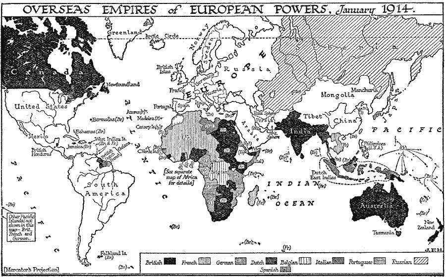
Description: A world map showing the foreign territories and island possessions of the European powers prior to WWI in January, 1914. This map shows the possessions of the British, French, German, Dutch, Belgian, Italian, Portuguese, Russian, and Spanish at the time.
Place Names: Regional Miscellaneous, Africa, �Asia, �Australia, �Europe, �North America, �South Americ
ISO Topic Categories: physical, �political, kWorldEurasia, kWorldEuroAfrica, kWorldAmericas
Keywords: Overseas Empires of European Powers, physical, �political, physical features, major political subdivisions,
country borders, physical, �political, kWorldEurasia, kWorldEuroAfrica, kWorldAmericas, Unknown, 1914
Source: H. G. Wells, The Outline of History (New York, NY: The Macmillan Company, 1921) 999
Map Credit: Courtesy the private collection of Roy Winkelman |
|