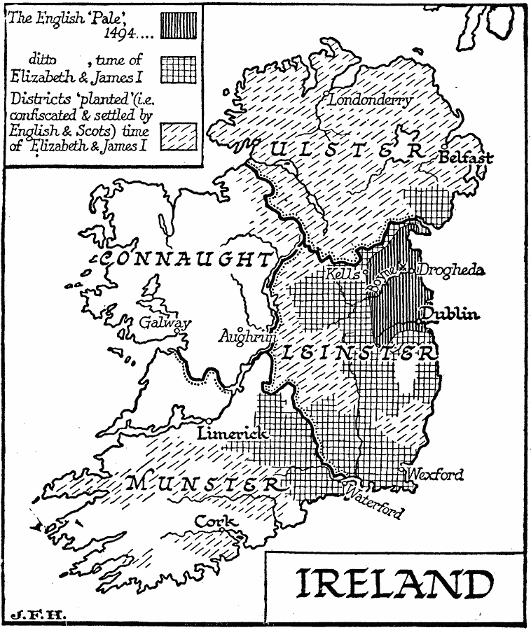
Description: A map of Ireland from the latter period of the English Pale (1492) to the time of Elizabeth and James I (1558–1625). The English "Pale" referred to the English controlled lands of Ireland, which by 1492 had been reduced, as shown on the map, to the area around Dublin and Drogheda. The map also shows the territories controlled by the Tudors under Queen Elizabeth and later under James I, King of Ireland, and the districts "planted (i.e. confiscated & settled by English & Scots)" at the time of Elizabeth and James I. The map shows the four provinces of Ireland (Ulster, Connaught, Leinster, and Munster), major cities, ports, and rivers, and the site of the Battle of Boyne (1690), between the Catholic King James and Protestant King William.
Place Names: Ireland, Limerick, �Dublin, �Galway, �Cor
ISO Topic Categories: location,
oceans,
inlandWaters,
boundaries
Keywords: Ireland, physical, �political, physical features, major political subdivisions, location,
oceans,
inlandWaters,
boundaries, Unknown, 1494
Source: H. G. Wells, The Outline of History (New York, NY: The Macmillan Company, 1921) 1016
Map Credit: Courtesy the private collection of Roy Winkelman |
|