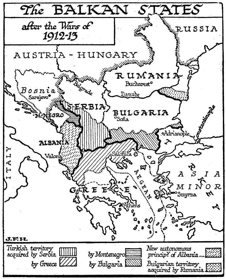
Description: A map of the Balkan States after the wars of 1912–1913 showing the European Turkish territories, the territories acquired by Serbia, Greece, Montenegro, and Bulgaria, the new autonomous principality of Albania, and the Bulgarian territory acquired by Rumania at the Treaty of Bucharest.
Place Names: Southeastern Europe, Austria-Hungary, �Bosnia, �Romania, �Bulgaria, �Serbia, �Greec
ISO Topic Categories: boundaries,
inlandWaters,
location,
oceans
Keywords: The Balkan Wars, physical, �political, kEuropeanOttomanEmpire, physical features, country borders, boundaries,
inlandWaters,
location,
oceans, Unknown, 1912–1913
Source: H. G. Wells, The Outline of History (New York, NY: The Macmillan Company, 1921) 1024
Map Credit: Courtesy the private collection of Roy Winkelman |
|