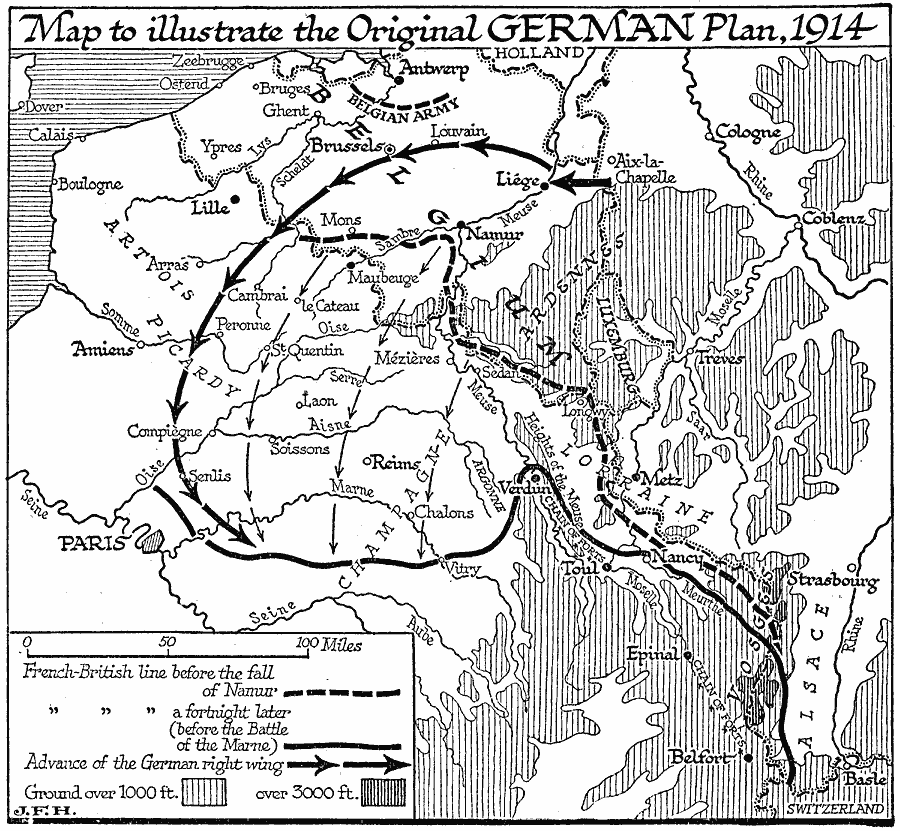
Description: A map to illustrate the original German plan of 1914 (a modified version of the Schlieffen Plan) on the Western Front, and shows the French–British defense lines before the fall of Namur (August 23, 1914) and just before the Battle of the Marne (September 6, 1914). The map shows the general direction of German advance, the advance of the German right wing, the Belgian Army positions to the south of Antwerp, and the French chain of fortification to the southeast of Verdun. This map also shows major cities of the Western Front, rivers, and areas of elevations over 1000 and 3000 feet.
Place Names: Western Europe, France, �Germany, �Belgiu
ISO Topic Categories: inlandWaters,
location,
intelligenceMilitary,
oceans,
boundaries
Keywords: Original German Plan on the Western Front, physical, �political, �historical, kWWI, physical features, country borders, WWI, inlandWaters,
location,
intelligenceMilitary,
oceans,
boundaries, Unknown, 1914
Source: H. G. Wells, The Outline of History (New York, NY: The Macmillan Company, 1921) 1035
Map Credit: Courtesy the private collection of Roy Winkelman |
|
