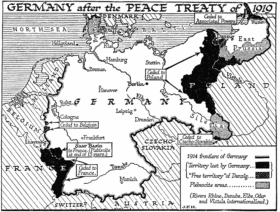
Description: A map showing the boundaries of Germany after the Treaty of Versailles in1919 showing the German boundary in 1914 and territories lost after the war, the "Free territory" of Danzig on the Baltic Coast, the Plebiscite areas in Schleswig, East Prussia, and Silesia, and the areas ceded to Poland, Czecho–Slovakia, Belgium, France, and the Associated Powers. This map notes that the rivers Rhine, Danube, Elbe, Oder, and Vistula were internationalized at the time.
Place Names: Germany, Germany, �France, �Czechoslovakia, �Prussia, �Switzerland, �Austria, �Belgium. �Holland, �Denmar
ISO Topic Categories: boundaries,
oceans,
location,
inlandWaters
Keywords: Germany After WWI, physical, �political, �historical, kWWI, physical features, country borders,
major political subdivisions, WWI, boundaries,
oceans,
location,
inlandWaters, Unknown, 1919
Source: H. G. Wells, The Outline of History (New York, NY: The Macmillan Company, 1921) 1075
Map Credit: Courtesy the private collection of Roy Winkelman |
|