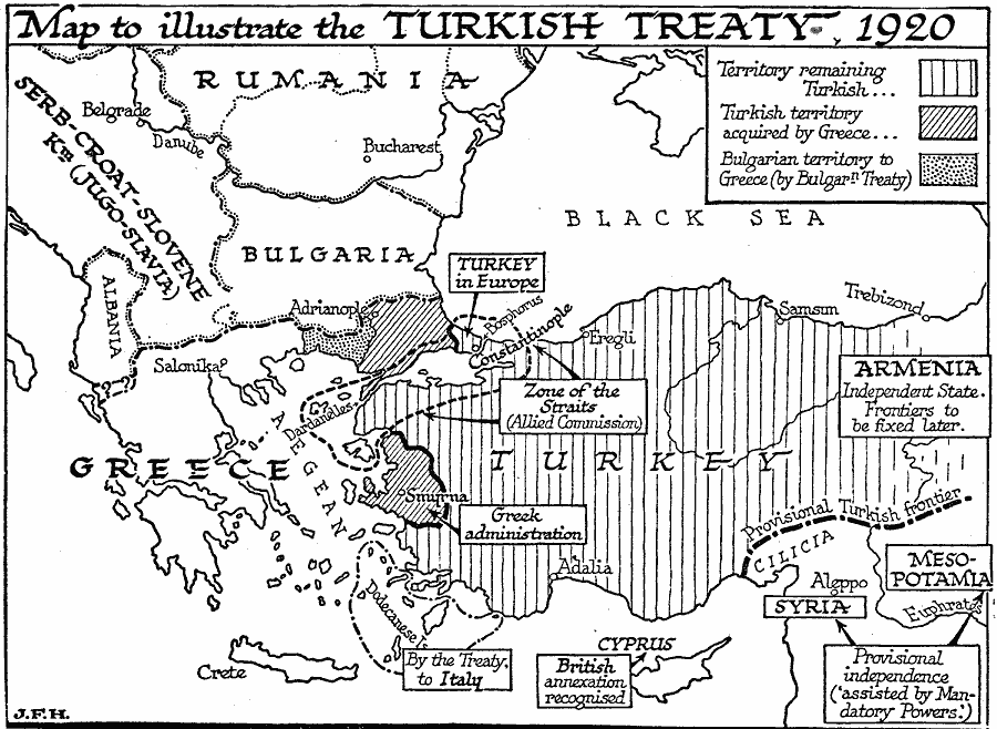
Description: A map of the Turkish territories after the partition by the Allies under the Treaty of Sévres in 1920. This map shows the areas remaining under Turkish control, including a small portion in Europe near the Bosphorus (Bosporus), the Zone of the Straits under the Allied Commission, the Turkish territory ceded to Greece, including Smyrna, and the provisional Turkish frontier to the north of Cilicia. The map also shows the Serb–Croat–Slovene Kingdom (Jugo–Slavia or Yugoslavia), the independent state of Armenia and the provisional independence of Syria and Mesopotamia under assistance of the Mandatory Powers (Britain and France), the Dodecanese Islands to Italy, and the annexation of Cyprus by Britain.
Place Names: Southeastern Europe, Greece, �Bulgaria, �Turkey, �Ottoman Empire, �Romania, �Albani
ISO Topic Categories: boundaries,
inlandWaters,
location,
oceans
Keywords: Ottoman Empire after WWI, physical, �political, kEuropeanOttomanEmpire, physical features, country borders,
major political subdivisions, boundaries,
inlandWaters,
location,
oceans, Unknown, 1920
Source: H. G. Wells, The Outline of History (New York, NY: The Macmillan Company, 1921) 1077
Map Credit: Courtesy the private collection of Roy Winkelman |
|