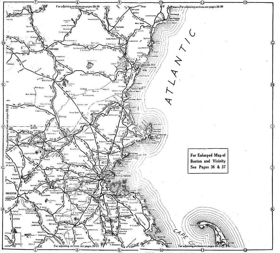
Description: Northern Massachusetts and southern Maine in 1919, showing roads.
Place Names: New England States, Boston, �Concord, �Cambridge, �New England, �Massachusetts, �Main
ISO Topic Categories: transportation,
location,
oceans,
inlandWaters,
boundaries
Keywords: Coastal New England from Massachusetts to southern Maine, physical, �political, �transportation, kAutomobile, physical features, major political subdivisions, roads, transportation,
location,
oceans,
inlandWaters,
boundaries, Unknown, 1919
Source: The Automobile Blue Book Company, Official Automobile Blue Book 1919 Vol 2 (New York, NY: The Automobile Blue Book Publishing Co., 1919) 24-25
Map Credit: Courtesy the private collection of Roy Winkelman |
|