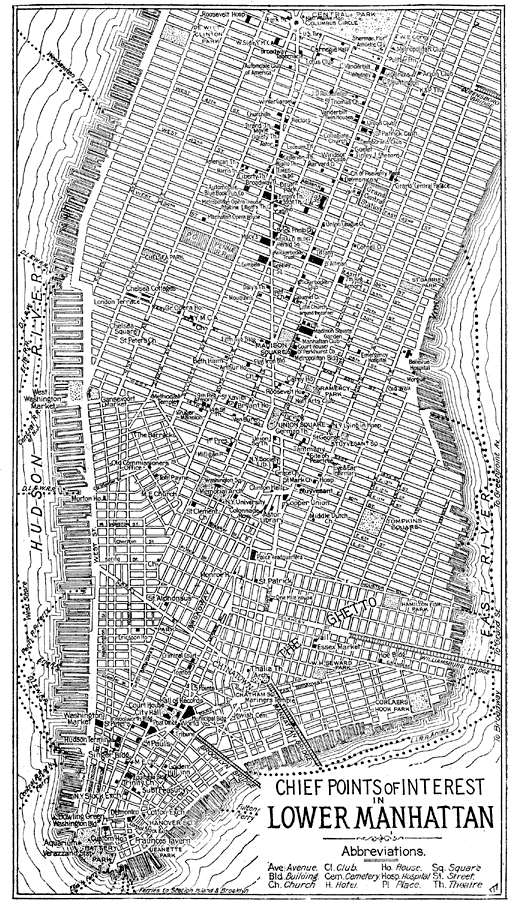
Description: A plan of Lower Manhattan from the Official Automobile Blue Book (1919), showing principal streets and avenues, and chief points of interest in the area.
Place Names: New York, New York City, �Manhatta
ISO Topic Categories: boundaries,
inlandWaters,
location,
transportation,
structure
Keywords: Lower Manhattan, physical, �political, �transportation, kAutomobile, physical features, country borders, roads, boundaries,
inlandWaters,
location,
transportation,
structure, Unknown, 1919
Source: The Automobile Blue Book Company, Official Automobile Blue Book 1919 Vol 2 (New York, NY: The Automobile Blue Book Publishing Co., 1919) 115
Map Credit: Courtesy the private collection of Roy Winkelman |
|