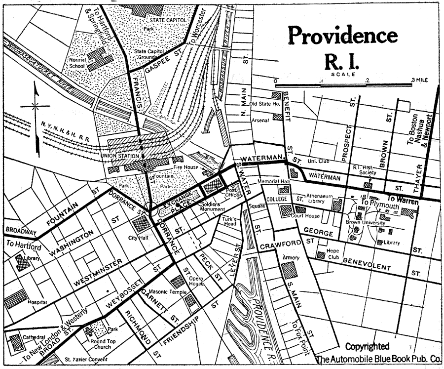
Description: A road map of Providence, Rhode Island, from the Official Automobile Blue Book (1919), showing the State Capitol, principal roads and streets, railroads and Union Station, parks, and major landmarks.
Place Names: Rhode Island, Providenc
ISO Topic Categories: location,
inlandWaters,
transportation
Keywords: Providence, Rhode Island, physical, �political, �transportation, kAutomobile, physical features, local jurisdictions, roads,
railroads, location,
inlandWaters,
transportation, Unknown, 1919
Source: The Automobile Blue Book Company, Official Automobile Blue Book 1919 Vol 2 (New York, NY: The Automobile Blue Book Publishing Co., 1919) 322
Map Credit: Courtesy the private collection of Roy Winkelman |
|