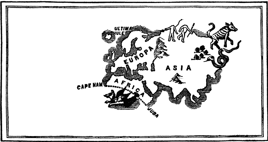
Description: A facsimile of a map of the world as known to Europe about the year 1418. This map "traced the outline of the world as known to the geographers of Europe in the first quarter of the fifteenth century. This was before the famous navigator, Prince Henry of Portugal, began to send out expeditions to explore the west coast of Africa. In place of the now known shape of that peninsula, the lower part is cut off by a slightly curved line running from Cape Nam — now Nun — on the west, to Juba on the east; the continent of America is wanting; Australia and the East Indies are wanting; and the pictured animals show the nameless terrors of the unknown coasts." — Scott, 1884, p. 1.
Place Names: A Complete Map of Globes and Multi-continent, Africa, �Asia, �Europ
ISO Topic Categories: oceans,
location,
inlandWaters,
boundaries
Keywords: The World as known to Europe , borders, �physical, �historical, kEarlyMapsFacsimile, country borders, oceans,
location,
inlandWaters,
boundaries, Unknown, 1418
Source: David B. Scott, A School History of the United States, from the discovery of America to the year 1880. (New York, NY: American Book Company, 1884) 2
Map Credit: Courtesy the private collection of Roy Winkelman |
|