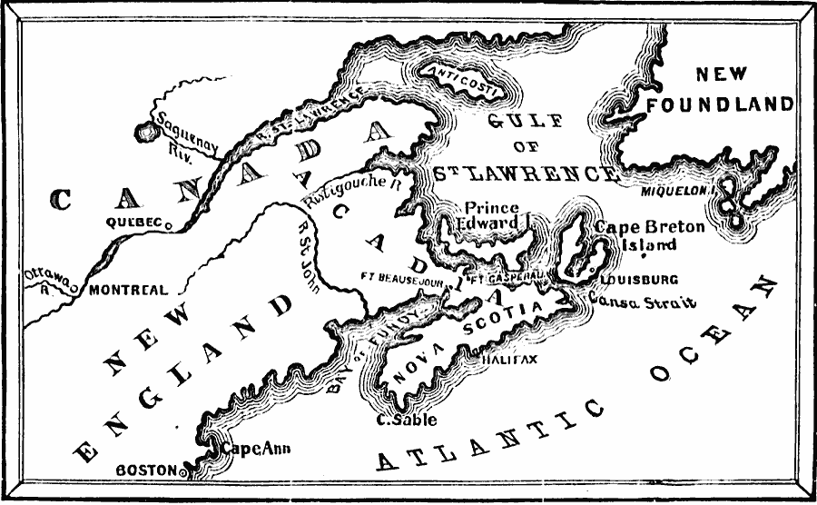
Description: A map of Acadia, Cape Breton Island, and Nova Scotia showing Boston and the battle sites of Fort Beauséjour and Fort Gaspareaux (1775) in Arcadia during the French and Indian War. The British victory under Winslow and Monckton resulted in a forced deportation of the Acadian populations from Nova Scotia and the Beaubassin region of Acadia.
Place Names: A Regional Map of North America, Acadia, �Breton Island, �Newfoundland, �Nova Scotia, �Canad
ISO Topic Categories: oceans,
location,
inlandWaters,
boundaries
Keywords: Acadia, Cape Breton Island, and Nova Scotia, borders, �physical, �historical, �military, �country borders, historical event,
other military, oceans,
location,
inlandWaters,
boundaries, Unknown, 1755
Source: David B. Scott, A School History of the United States, from the discovery of America to the year 1880. (New York, NY: American Book Company, 1884) 130
Map Credit: Courtesy the private collection of Roy Winkelman |
|