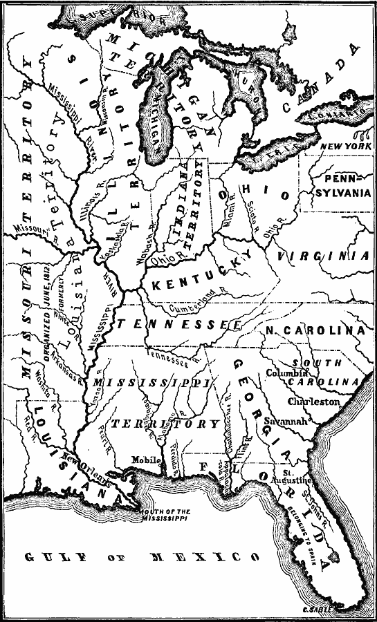
Description: The states and territories in the south and west in 1812.
Place Names: Growth of Nation, Florida, �Georgia, �Illinois, �Indiana, �Kentucky, �Louisiana, �Michigan, �Mississippi, �Missouri, �New York, �North Carolina, �Ohio, �Pennsylvania, �South Carolina, �Tennessee, �Virginia, �Mississippi River, �The South, �Southern United States, �Nort
ISO Topic Categories: oceans,
location,
inlandWaters
Keywords: States and Territories in the South and West, physical, �historical, �military, �war, �country borders, historical event, oceans,
location,
inlandWaters, Unknown, 1812
Source: David B. Scott, A School History of the United States, from the discovery of America to the year 1880. (New York, NY: American Book Company, 1884) 250
Map Credit: Courtesy the private collection of Roy Winkelman |
|