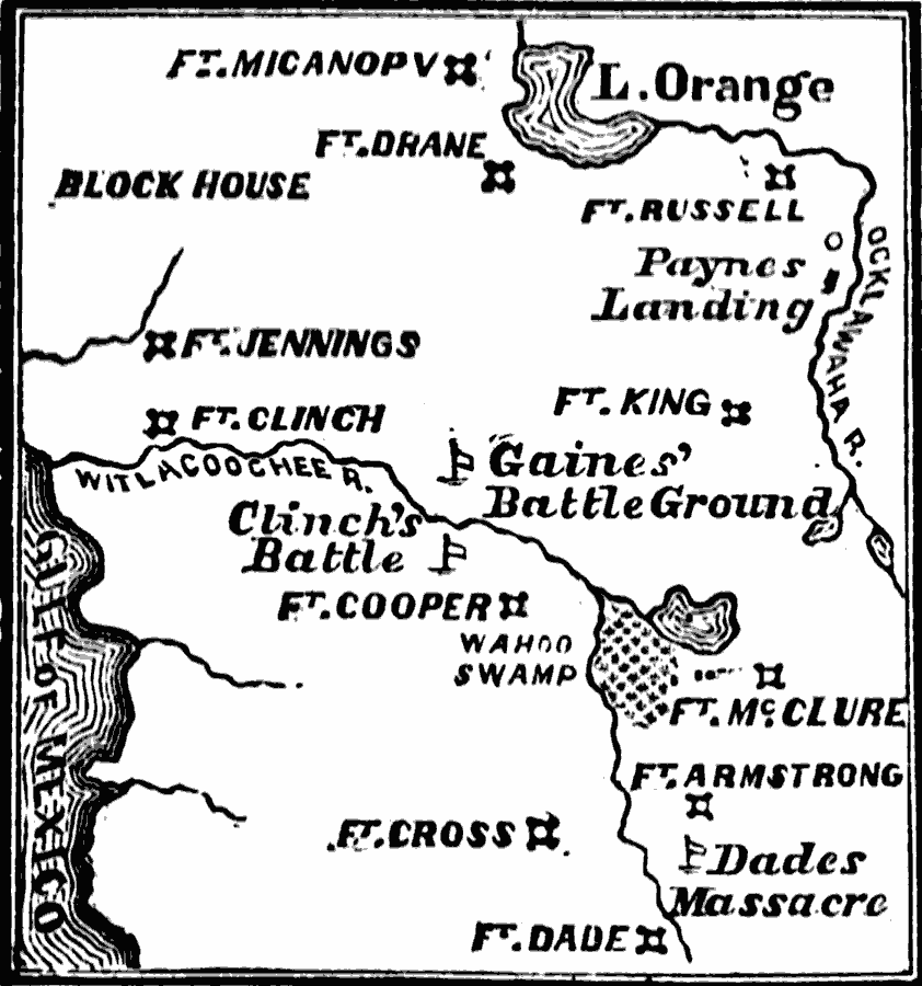
Description: The scene of the Seminole War in 1835.
Place Names: Florida, Dade, �Florida, �Gainesvill
ISO Topic Categories: oceans,
location,
inlandWaters
Keywords: Scene of the Seminole War, physical, �historical, �military, �war, �country borders, historical event, oceans,
location,
inlandWaters, Unknown, 1835–1836
Source: David B. Scott, A School History of the United States, from the discovery of America to the year 1880. (New York, NY: American Book Company, 1884) 281
Map Credit: Courtesy the private collection of Roy Winkelman |
|