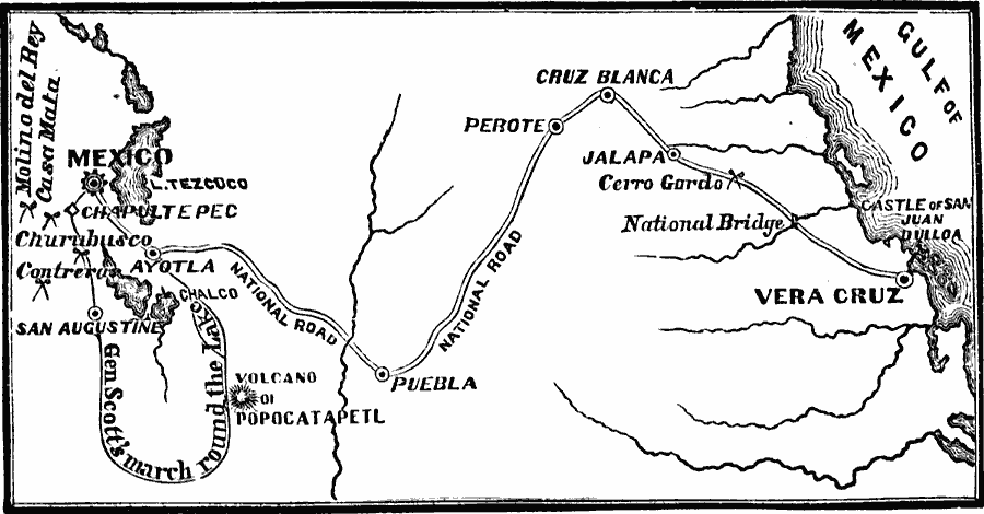
Description: A map of the 1847 campaign of General Scott from Veracruz to the City of Mexico during the Mexican–American War (1846–1848). The map shows the battle site of the Castle of San Juan Ulloa, Cerro Gordo, Molino Del Rey, Chapultepec, Casa Malta, Contreras, and Churubusco. The map also shows the route of Scott around the lake from Ayotla to San Augustine, and on to the City of Mexico.
Place Names: A Regional Map of North America, Ayotla, �Churabusco, �Mexico, �Vera Cru
ISO Topic Categories: oceans,
location,
inlandWaters
Keywords: General Scott's Campaign in Mexico, physical, �historical, �military, �war, �country borders, historical event, oceans,
location,
inlandWaters, Unknown, 1847
Source: David B. Scott, A School History of the United States, from the discovery of America to the year 1880. (New York, NY: American Book Company, 1884) 298
Map Credit: Courtesy the private collection of Roy Winkelman |
|