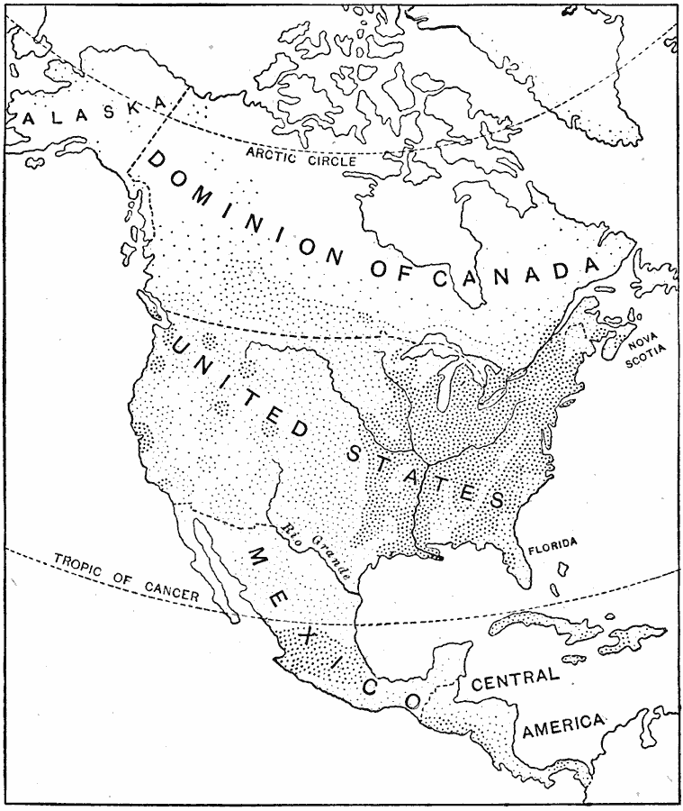
Description: A base map from 1921 of North America, Central America, and the Caribbean showing the general population distribution in Alaska, Greenland, Dominion of Canada, United States, Mexico, and Central America at the time. People are most numerous where the dots are thickest.
Place Names: A Complete Map of North America, Bahamas, �Canada, �Cuba, �Mexico, �United State
ISO Topic Categories: oceans,
inlandWaters,
location
Keywords: Population Distribution of North America, physical, �population, �statistical, kPopulation, population, oceans,
inlandWaters,
location, Unknown, 1921
Source: Jacques W. Redway and Russell Hinman, Natural Elementary Geography (New York, NY: American Book Company , 1921) 31
Map Credit: Courtesy the private collection of Roy Winkelman |
|