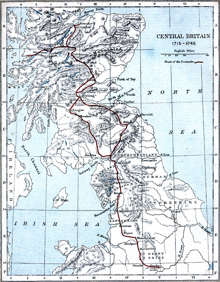
Description: A map of Central Britain during the time of the First Jacobite Rebellion (1715) led by James Francis Edward Stuart (the Old Pretender) to the Second Jacobite Rebellion (1745) led by Charles Edward Stuart (the Young Pretender). The map shows the route of the Young Pretender from his return from France to northwestern Scotland (Moidart) to Edinburgh, through Northumberland and Lancashire as far south as Derby in Derbyshire (December 5, 1745), and his march to Culloden Moore (April 16, 1746).
Place Names: United Kingdom, Firth of Forth, �Dunbar, �Berwick, �Newcastle, �Carlisle, �Durham, �Manchester, �Derby, �Preston, �Lancaster, �Glasgow, �Stirling, �Edinburgh, �Edinborough, �Perth, �Glengary, �Invernes
ISO Topic Categories: inlandWaters,
location,
oceans,
boundaries
Keywords: Central Britain, physical, �political, �historical, �route of the pretender, central britain 1715 to 1745, physical features, country borders, historical event, inlandWaters,
location,
oceans,
boundaries, Unknown, 1715–1745
Source: Samuel Rawson Gardiner D.C.L., L.L.D., School Atlas of English History (London, England: Longmans, Green, and Co., 1914) 42
Map Credit: Courtesy the private collection of Roy Winkelman |
|