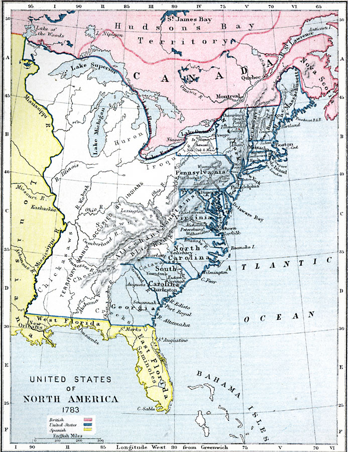
Description: Eastern North America shortly after the American Revolution, showing territory held by the United States, Britain, and Spain.
Place Names: A Regional Map of North America, Canada, �United States, �Hudson's Bay Territory, �Nova Scotia, �Massachusetts, �Boston, �Pennsylvania, �Philadelphia, �New York, �Virginia, �North Carolina, �South Carolina, �Georgia, �East Florida, �West Florida, �Louisiana, �Alleghany Mountain
ISO Topic Categories: inlandWaters,
location,
boundaries,
oceans
Keywords: United States of America, physical, �political, �united states of north america in 1783, british territory, united states territory, spanish territory, �historical, physical features, country borders,
major political subdivisions, American Revolution, inlandWaters,
location,
boundaries,
oceans, Unknown, 1783
Source: Samuel Rawson Gardiner D.C.L., L.L.D., School Atlas of English History (London, England: Longmans, Green, and Co., 1914) 48
Map Credit: Courtesy the private collection of Roy Winkelman |
|