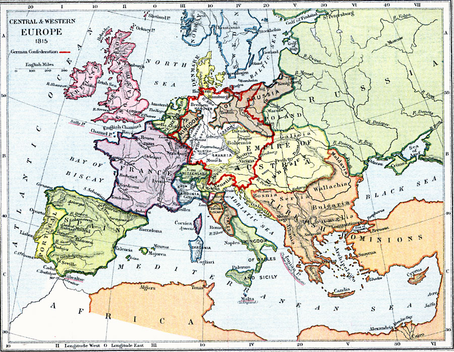
Description: A map showing Central and Western Europe in 1815 with the boundary of the German Confederation given in red. The map shows terrain features, lakes, rivers, principal cities, and battle sites of the region.
Place Names: Western and Central Europe, Ireland, �England, �Scotland, �France, �Portugal, �Spain, �Switzerland, �Russia, �Denmark, �Venetia, �Dalmatia, �Prussia, �Sweden, �Norwa
ISO Topic Categories: inlandWaters,
location,
boundaries,
oceans
Keywords: Central and Western Europe, physical, �political, �central and western europe in 1815 showing the german confederation, physical features, country borders,
major political subdivisions, inlandWaters,
location,
boundaries,
oceans, Unknown, 1815
Source: Samuel Rawson Gardiner D.C.L., L.L.D., School Atlas of English History (London, England: Longmans, Green, and Co., 1914) 59
Map Credit: Courtesy the private collection of Roy Winkelman |
|