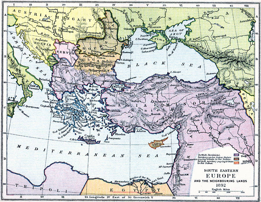
Description: A map of southeastern Europe and surrounding lands, showing the extent of the Ottoman Empire in 1892. The map is color–coded to show the Turkish dominions, the territories under native rulers and the British territory paying tribute to the Sultan at the time.
Place Names: Southeastern Europe, Austria-Hungary, �Servia, �Bosnia, �Montenegro, �Turkis Dominions, �Bulgaria, �Roumania, �Crimea, �Caucasus, �Syria, �Egypt, �Tripoli, �Italy, �Cair
ISO Topic Categories: inlandWaters,
location,
boundaries,
oceans
Keywords: South Eastern Europe and Turkey, physical, �political, �southeastern europe and its neighboring lands in 1892, turkish dominions, territory under native rulers paying tribute to the sultan, british territory paying tribute to the sultan, physical features,
topographical, country borders, inlandWaters,
location,
boundaries,
oceans, Unknown, 1892
Source: Samuel Rawson Gardiner D.C.L., L.L.D., School Atlas of English History (London, England: Longmans, Green, and Co., 1914) 63
Map Credit: Courtesy the private collection of Roy Winkelman |
|