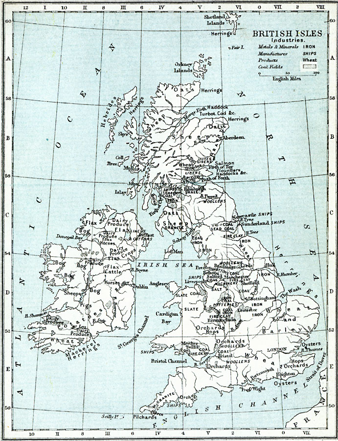
Description: A map from 1914 of the British Isles showing the areas of commercial production including agricultural, fishery, mineral, and manufacturing products. The coalfields of the islands are shown as shaded areas. Major cities, rivers, and coastal features are shown.
Place Names: United Kingdom, Orkney Islands, �Hebrides, �Dundee, �Glasgow, �Edinburgh, �Edinborough, �Newcastle, �Sunderland, �Bolton, �Leeds, �Hull, �Nottingham, �Manchester, �Sheffield, �Liverpool, �Leicester, �London, �Brighton, �Portsmouth, �Bristol, �Belfast, �Dubli
ISO Topic Categories: inlandWaters,
location,
boundaries,
oceans
Keywords: Industry of the British Isles, physical, �political, �statistical, �industries of the british isles, metals and minerals iron, manufactures ships, products, wheat, coal fields, herrings, �salt, coal, flax, sheep, bog, fire clay, hops, woolens, shale, sheep, oats, kEconomic, physical features,
topographical, country borders, industry, inlandWaters,
location,
boundaries,
oceans, Unknown, 1914
Source: Samuel Rawson Gardiner D.C.L., L.L.D., School Atlas of English History (London, England: Longmans, Green, and Co., 1914) 64
Map Credit: Courtesy the private collection of Roy Winkelman |
|