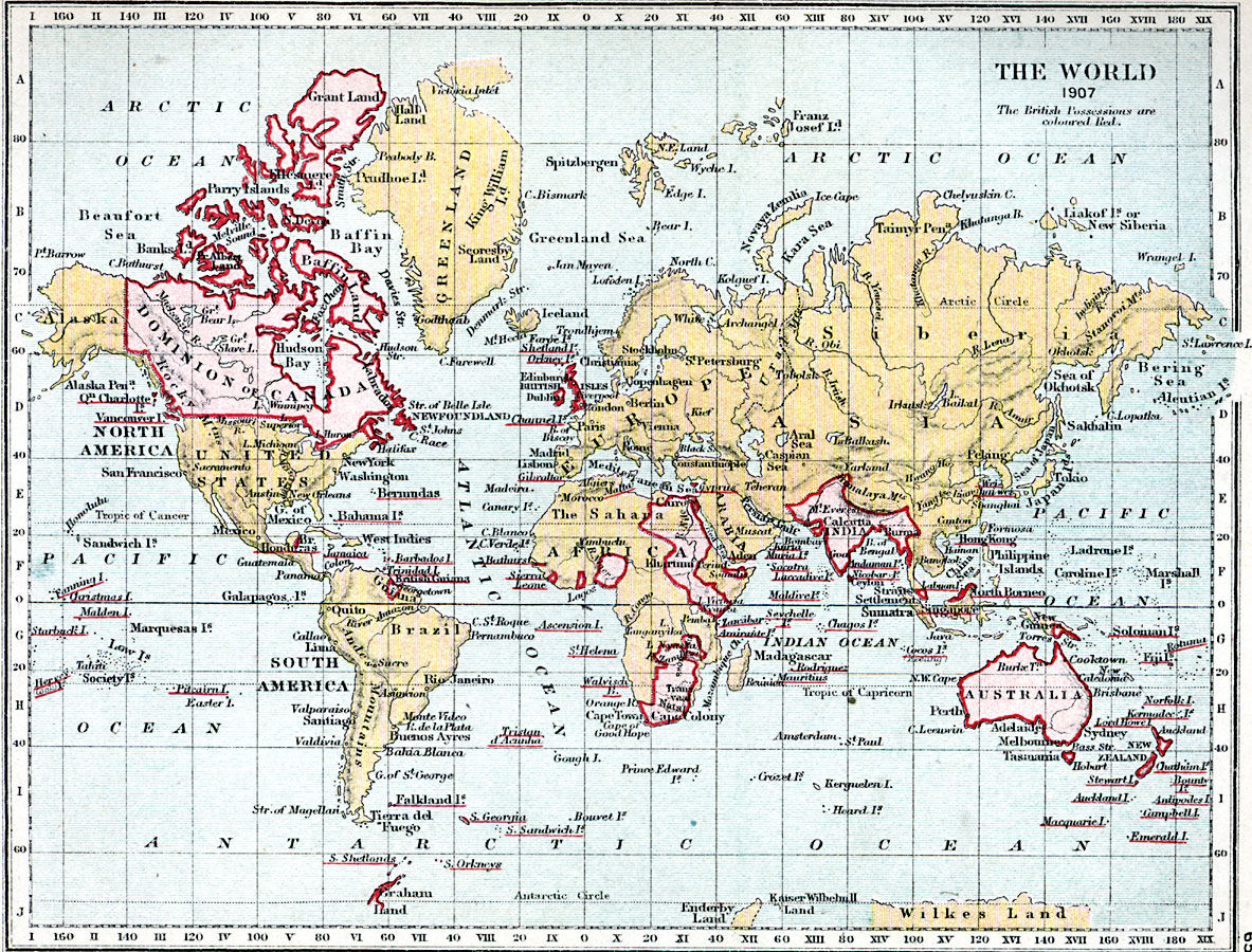
Description: World map showing world in 1907 with British possessions colored red.
Place Names: A Complete Map of Globes and Multi-continent, Africa, �Asia, �Australia, �Europe, �North America, �South America, �Antarctica, �United States, �Canada, �Brazil, Alaska, Greenland, Great Britain, Russia, Madagascar, Bering Se
ISO Topic Categories: inlandWaters,
location,
boundaries,
oceans
Keywords: World Map, physical, �political, �world map showing british possessions coloured red in 1907, colored red, physical features, country borders, inlandWaters,
location,
boundaries,
oceans, Unknown, 1907
Source: Samuel Rawson Gardiner D.C.L., L.L.D., School Atlas of English History (London, England: Longmans, Green, and Co., 1914) 65
Map Credit: Courtesy the private collection of Roy Winkelman |
|