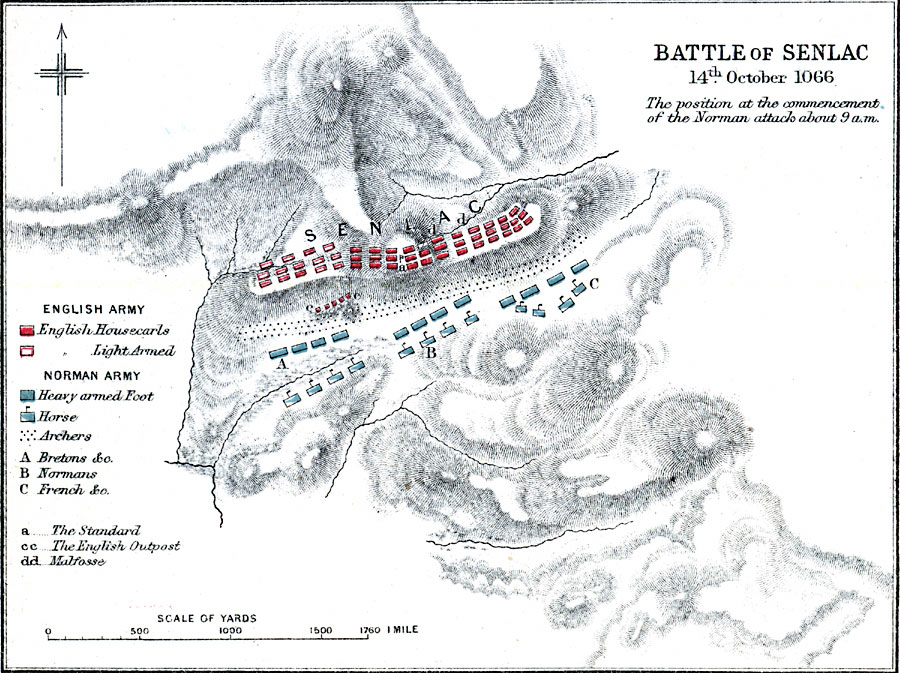
Description: A map of the Battle of Senlac, or Battle of Hastings, on 14 October, 1066 in East Sussex, England during the Norman Conquest of England. The battle, between the Norman army under William I (William the Conqueror) and the English forces under Harold Godwinson, resulted in a decisive Norman victory. The map is color–coded to show the positions of each army, with notations on armament, and shows the terrain features and rivers of the battle site.
Place Names: United Kingdom, Senlac Hill, �Hasting
ISO Topic Categories: inlandWaters,
location
Keywords: Battle of Senlac, physical, �historical, �battle of senlac hill, battle of santlache, battle of hastings, norman invasion, kBattle, physical features,
topographical, other military, inlandWaters,
location, Unknown, October 14, 1066
Source: Samuel Rawson Gardiner D.C.L., L.L.D., School Atlas of English History (London, England: Longmans, Green, and Co., 1914) 67
Map Credit: Courtesy the private collection of Roy Winkelman |
|