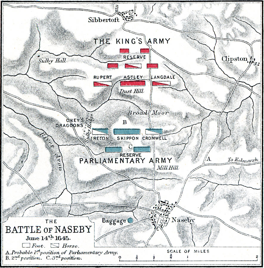
Description: A map of the Battle of Naseby on 14 June, 1645, near Broad Moore in Northamptonshire, England during the First English Civil War (1642–1646). The battle, between the Royalist army under King Charles I and the Parliamentarian New Model army under Sir Thomas Fairfax and Oliver Cromwell, resulted in a decisive victory by the Parliamentarians. The map is color–coded to show the positions of each army, the cities of Naseby and Sibbertoft, River Avon, and terrain features of the area.
Place Names: United Kingdom, Sibbertoft, �Clipston, �Sulby Hall, �Broad Moor, �Baggage, �Naseby, �Milly Hill, �River Avo
ISO Topic Categories: inlandWaters,
location
Keywords: Battle of Naseby, physical, �historical, �battle of naseby, probably 1st position of parliamentary army, first position, second position, 2nd position, third position, 3rd position, okey's dragoons, ireton, skippon, cromwell, rupert, astley, langdale, kBattle, physical features,
topographical, other military, inlandWaters,
location, Unknown, June 14, 1645
Source: Samuel Rawson Gardiner D.C.L., L.L.D., School Atlas of English History (London, England: Longmans, Green, and Co., 1914) 74
Map Credit: Courtesy the private collection of Roy Winkelman |
|