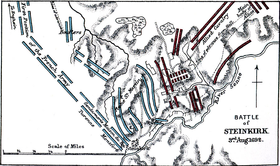
Description: A map of the Battle of Steinkirk (Steenkerque), Belgium, during the Nine Years' War on 3 August, 1692, between the victorious French army under the duc de Luxembourg and the allied forces of the British, Dutch, and Germans under William of Orange. The map shows the military positions, lines of advance, neighboring towns, and the River Senne.
Place Names: Belgium, Steinkirk, �Steenkerque, �Plaine St. martin, �River Senn
ISO Topic Categories: inlandWaters,
location
Keywords: Battle of Steinkirk, physical, �historical, �battle of steinkirk, battle of steenkerque, battle of steenkerk, battle of steenkirk, advance guard of allies attacking french right, first line of right wing of french in support, turenne, montfort, gendarmerie maison du boi, bouflers, line of advance, allied cavalry, physical features,
topographical, other military, inlandWaters,
location, Unknown, August 3, 1692
Source: Samuel Rawson Gardiner D.C.L., L.L.D., School Atlas of English History (London, England: Longmans, Green, and Co., 1914) 76
Map Credit: Courtesy the private collection of Roy Winkelman |
|