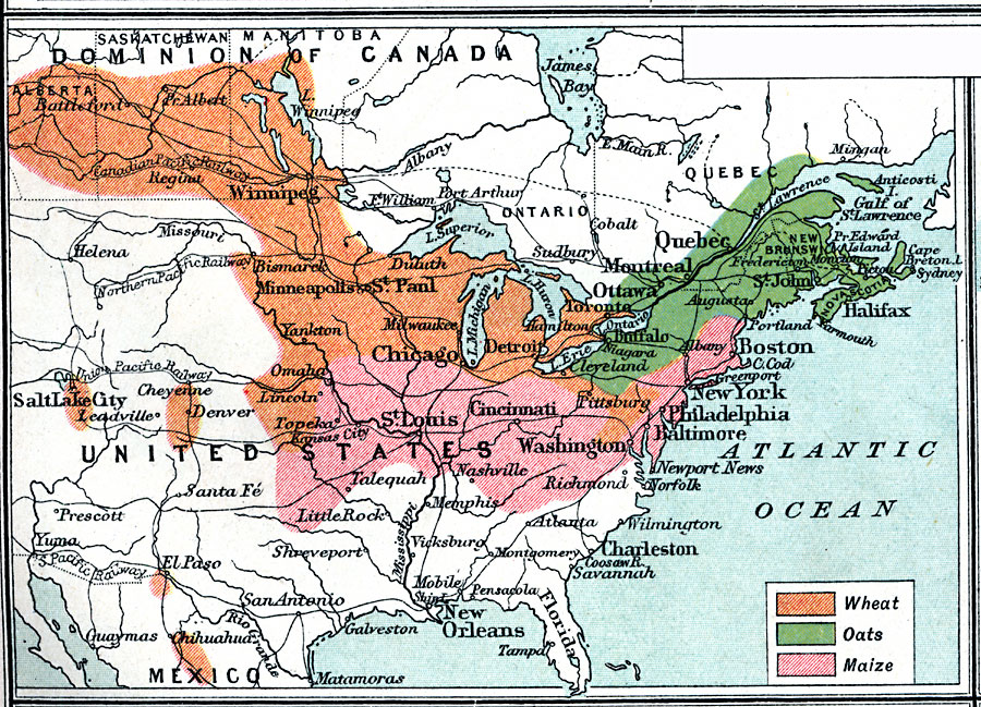
Description: Grain production of four major continents.
Place Names: A Regional Map of North America, Canada, �Mexico, �United State
ISO Topic Categories: inlandWaters,
oceans,
location,
boundaries,
transportation,
farming,
economy
Keywords: Granaries of the World, physical, �political, �borders, �boundaries, �statistical, �agriculture, �industry, �economic, �graneries, �wheat, �oats, �maize, physical features, country borders, agriculture,
industry,
economic, inlandWaters,
oceans,
location,
boundaries,
transportation,
farming,
economy, Unknown, 1915
Source: J. G. Bartholomew, A School Economic Atlas (London, England: Oxford University Press, 1915) 51
Map Credit: Courtesy the private collection of Roy Winkelman |
|