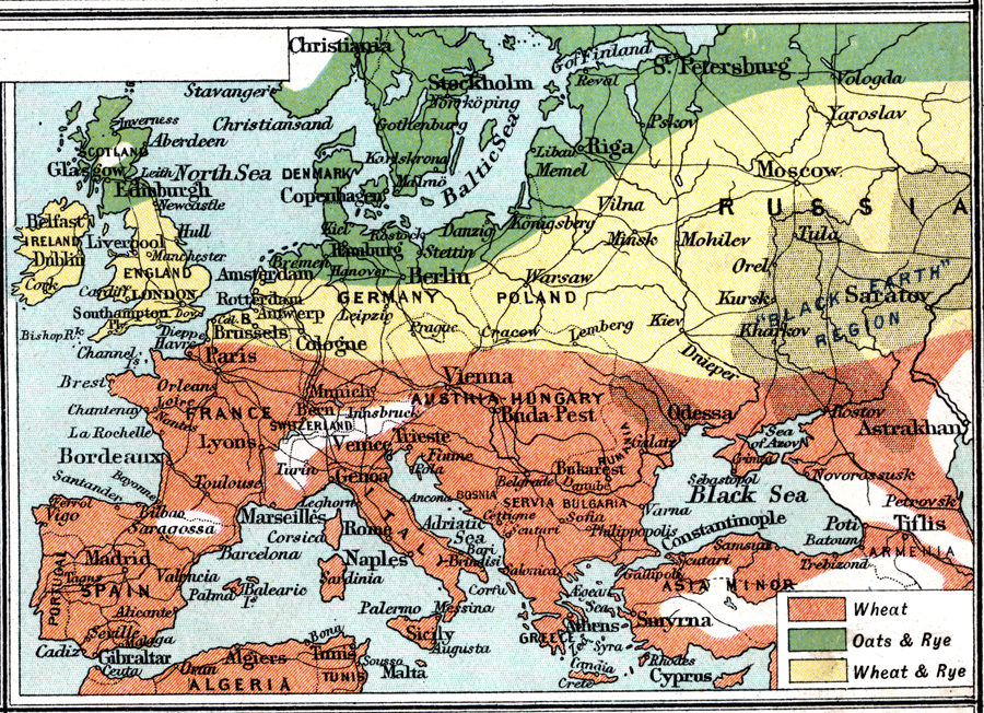
Description: A map from 1915 of western and central Europe showing the principal grain producing regions. The map is keyed to show the regions of primarily wheat, regions of oats and rye, and regions of wheat and rye.
Place Names: Western and Central Europe, France, �Germany, �Greece, �Italy, �Poland, �Portugal, �Romania, �Spain, �Sweden, �United Kingdo
ISO Topic Categories: inlandWaters,
oceans,
location,
boundaries,
transportation,
farming,
economy
Keywords: Granaries of Europe, physical, �political, �borders, �boundaries, �statistical, �agriculture, �industry, �economic, �graneries, �wheat, �oats, �rye, physical features, country borders, agriculture,
industry,
economic, inlandWaters,
oceans,
location,
boundaries,
transportation,
farming,
economy, Unknown, 1915
Source: J.G. Bartholomew, A School Economic Atlas (London, England: Oxford University Press, 1915) 51
Map Credit: Courtesy the private collection of Roy Winkelman |
|