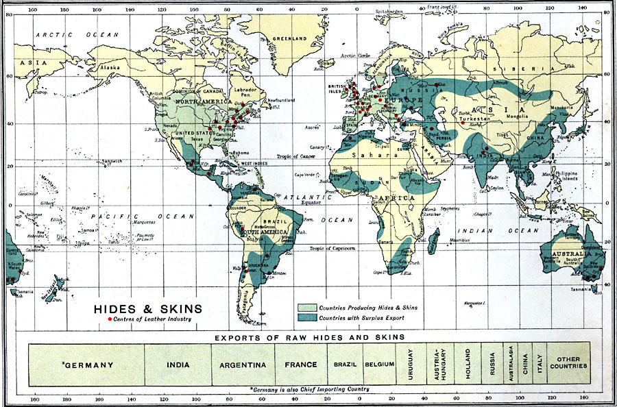
Description: A map showing world leather production, sorted by continent.
Place Names: A Complete Map of Globes and Multi-continent, Africa, �Antarctica, �Asia, �Australia, �Europe, �North America, �South Americ
ISO Topic Categories: inlandWaters,
oceans,
location,
boundaries,
farming,
economy
Keywords: Hides and Skins, physical, �political, �borders, �boundaries, �agriculture, �industry, �economic, �cattle, �hides, �skins, �leather,�statistical, physical features, country borders, economic,
agriculture,
industry, inlandWaters,
oceans,
location,
boundaries,
farming,
economy, Unknown, 1915
Source: J.G. Bartholomew, A School Economic Atlas (London, England: Oxford University Press, 1915) 57
Map Credit: Courtesy the private collection of Roy Winkelman |
|