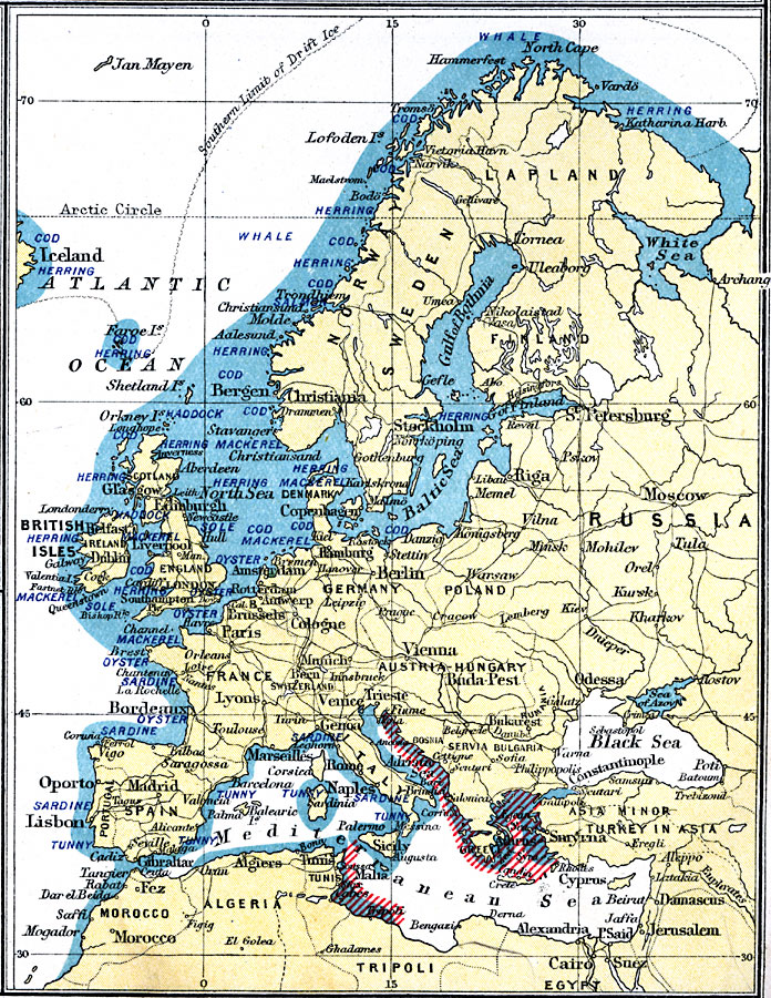
Description: A map from 1915 showing the principal fishing grounds of Europe. The map shows the chief types of fish produced in the areas. The map shows principal cities and ports, railroads, rivers, and coastal features.
Place Names: A Complete Map of Europe, France, �Germany, �Greece, �Italy, �Poland, �Portugal, �Romania, �Spain, �Sweden, �United Kingdo
ISO Topic Categories: inlandWaters,
oceans,
location,
boundaries,
transportation,
farming,
economy
Keywords: Fisheries of Europe, physical, �political, �borders, �boundaries, �agriculture,�industry, �economic, �fish, �fisheries, �statistical, physical features, country borders, agriculture,
industry,
economic, inlandWaters,
oceans,
location,
boundaries,
transportation,
farming,
economy, Unknown, 1915
Source: J.G. Bartholomew, A School Economic Atlas (London, England: Oxford University Press, 1915) 58
Map Credit: Courtesy the private collection of Roy Winkelman |
|