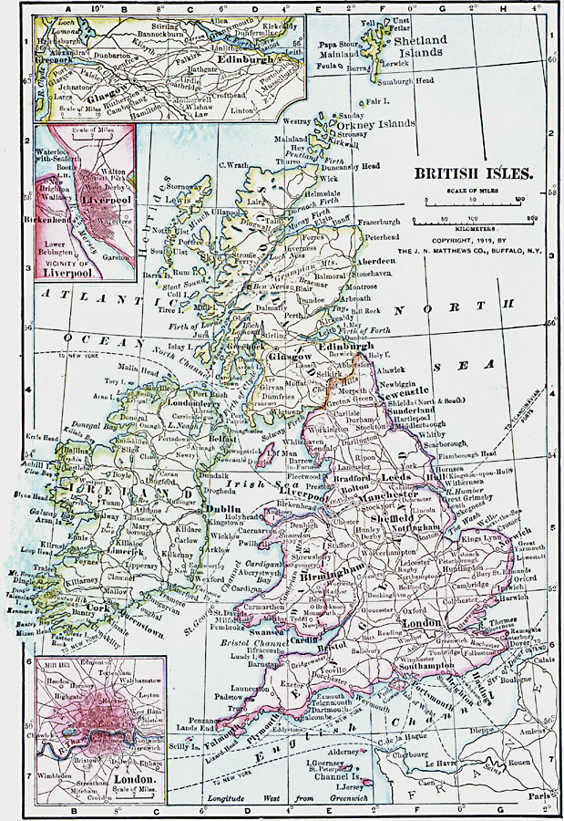
Description: A map from 1919 of the British Isles showing borders and boundaries after World War I. The map shows principal cities and ports, railroads, canals, steam ship routes, rivers, and coastal features. Inset maps detail the vicinities of Edinburgh–Glasgow, Liverpool, and London.
Place Names: British Isles, England, �Ireland, �Scotland, �United Kingdo
ISO Topic Categories: boundaries,
inlandWaters,
location,
oceans
Keywords: British Isles, physical, �political, �borders, �boundaries, �historical, �World War I, �WWI, physical features, country borders, WWI, boundaries,
inlandWaters,
location,
oceans, Unknown, 1914–1919
Source: Merton M. Wilner, A New Atlas of the New World Corrected According to the Peace Terms Together with a Graphic Story of the Great War 1914-1919 (New York, NY: The Christian Herald, 1919) 2
Map Credit: Courtesy the private collection of Roy Winkelman |
|