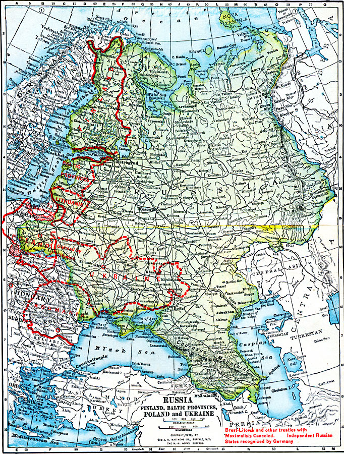
Description: A map from 1919 of the eastern European countries showing borders and boundary changes after World War I. The map shows principal cities and ports, railroads, canals, mountain systems, rivers, and coastal features.
Place Names: Eastern Europe, Baltic provinces, �Finland, �Lithuania, �Poland, �Russia, �Ukraine, �Romani
ISO Topic Categories: boundaries,
inlandWaters,
location,
oceans
Keywords: Russia, Finland, Baltic Provinces, Poland, and Ukraine, physical, �political, �borders, �boundaries, �historical, �World War I, �WWI, physical features, country borders, WWI, boundaries,
inlandWaters,
location,
oceans, Unknown, 1914–1919
Source: Merton M. Wilner, A New Atlas of the New World Corrected According to the Peace Terms Together with a Graphic Story of the Great War 1914-1919 (New York, NY: The Christian Herald, 1919) 10-11
Map Credit: Courtesy the private collection of Roy Winkelman |
|