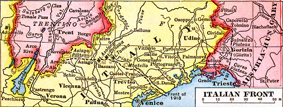
Description: A map from 1919 of the northeastern Italian fronts during World War I, including the front in 1917 and in 1918. The map shows principal cities and ports, railroads, mountains, rivers, and coastal features.
Place Names: Italy, Austria, �Hungary, �Ital
ISO Topic Categories: boundaries,
inlandWaters,
location,
oceans
Keywords: Italian Front, physical, �political, �borders, �boundaries, �historical, �World War I, �WWI, �fronts, physical features, country borders, WWI, boundaries,
inlandWaters,
location,
oceans, Unknown, 1914–1919
Source: Merton M. Wilner, A New Atlas of the New World Corrected According to the Peace Terms Together with a Graphic Story of the Great War 1914-1919 (New York, NY: The Christian Herald, 1919) 15
Map Credit: Courtesy the private collection of Roy Winkelman |
|