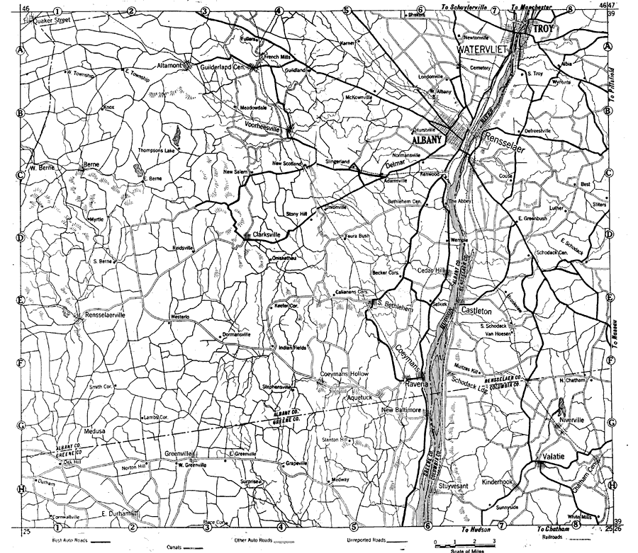
Description: A road map of New York in the vicinity of Albany from the Official Automobile Blue Book (1919), showing county lines, principal cities and towns, rivers, and is keyed to show the best auto routes, other auto routes, unreported roads, railroads, and canals.
Place Names: New York, Troy, �Alban
ISO Topic Categories: boundaries,
location,
inlandWaters,
transportation
Keywords: Albany and Vicinity, physical, �political, �transportation, kAutomobile, physical features, local jurisdictions,
county borders, roads,
railroads, boundaries,
location,
inlandWaters,
transportation, Unknown, 1919
Source: The Automobile Blue Book Company, Official Automobile Blue Book 1919 Vol 2 (New York, NY: The Automobile Blue Book Publishing Co., 1919) 1160-1161
Map Credit: Courtesy the private collection of Roy Winkelman |
|