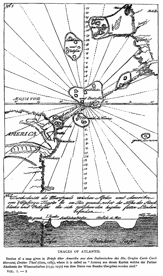
Description: A chart of the Atlantic Ocean from 1785 showing a cross–section and soundings of the ocean floor from Cape Tagrin in Sierra Leon, Africa, to Rio Grande (Rio Grande do Norte), Brazil. The chart is in German, describing an expedition from the Paris Academy of Sciences (1737, 1752). This chart has been used to suggest the mythical lost continent of Atlantis lying in the submerged section of the mid–Atlantic
Place Names: Regional Atlantic Ocean, Atlantis, �North America, �South Americ
ISO Topic Categories: physical, kWorldAtlantic
Keywords: Traces of Atlantis, physical, physical features, physical, kWorldAtlantic, Unknown, 1785
Source: Justin Winsor, Narrative and Critical History of America Vol 1 (New York, NY: Houghton, Mifflin, and Company, 1889) 17
Map Credit: Courtesy the private collection of Roy Winkelman |
|