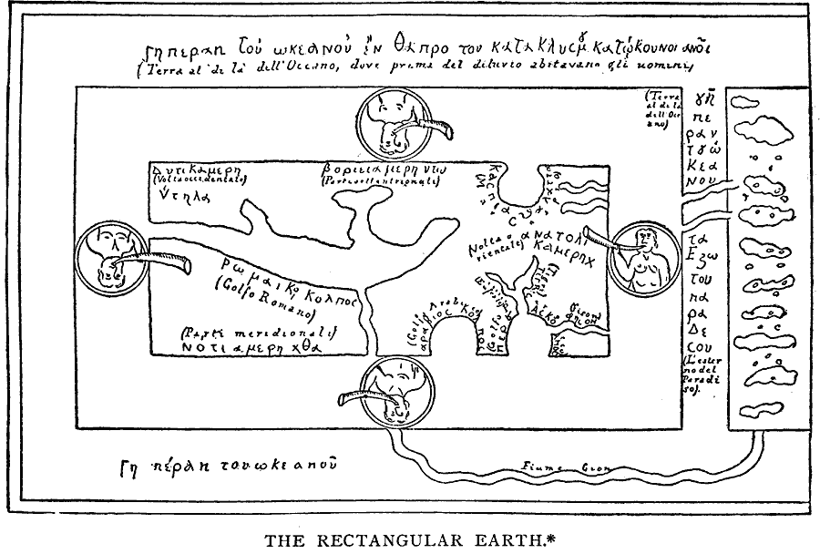
Description: A facsimile of a map of the world from the Middle Ages. "The geographical doctrines which antiquity bequeathed to the Middle Ages were briefly these: that the earth was a sphere with a circumference of 252,000 or 180,000 stadia; that only the temperate zones were inhabitable, and the northern alone known to be inhabited; that the southern, owing to the impassable heats of the torrid zone, it could not be discovered whether it were inhabited, or whether, indeed, land existed there; and that of the northern, it was unknown whether the intervention of another continent, or only the shoals and unknown horrors of the ocean, prevented a westward passage from Europe to Asia. The legatee preserved, but did not improve his inheritance. It has been supposed that the early Middle Ages, under the influence of barbarism and Christianity, ignored the sphericity of the earth, deliberately returning to the assumption of a plane surface, either wheel-shaped or rectangular." — Winsor, 1889, p. 30.
Place Names: Regional Miscellaneous, Europ
ISO Topic Categories: physical, kEarlyMapsFacsimile, kWorldMedSea, kWorldAfroAsia
Keywords: The Rectangular Earth, physical, kEarlyMapsFacsimile, physical features, physical, kEarlyMapsFacsimile, kWorldMedSea, kWorldAfroAsia, Unknown, AD 450–1450
Source: Justin Winsor, Narrative and Critical History of America Vol 1 (New York, NY: Houghton, Mifflin, and Company, 1889) 30
Map Credit: Courtesy the private collection of Roy Winkelman |
|