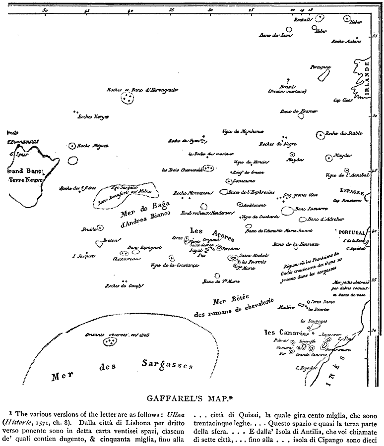
Description: A facsimile from a map of the North Atlantic by Jacques Gaffarel (1601–1681), showing "such rocks and islets as have from time to time been reported as seen, or thought to have been seen, and which Gaffarel views as vestiges of the lost continent [of Atlantis]." (Winsor, 1889)
Place Names: Regional Atlantic Ocean, Atlantic Ocean�Europ
ISO Topic Categories: physical, kEarlyMapsFacsimile, kWorldAtlantic
Keywords: Gaffarel's Map of the Atlantic, physical, kEarlyMapsFacsimile, physical features, physical, kEarlyMapsFacsimile, kWorldAtlantic, Unknown, 1571
Source: Justin Winsor, Narrative and Critical History of America Vol 1 (New York, NY: Houghton, Mifflin, and Company, 1889) 52
Map Credit: Courtesy the private collection of Roy Winkelman |
|