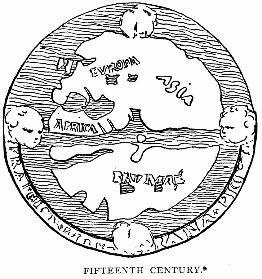
Description: A facsimile of a world map from the fifteenth century, showing a conventional map of the older period, which is given in Santarem's Atlas as a "Mappemonde qui se trouve au revers d'une Médaille du Commencement du XVe Siècle."
Place Names: A Complete Map of Globes and Multi-continent, Africa, �Asia, �Europ
ISO Topic Categories: location,
oceans
Keywords: Early Map of the World, physical, kEarlyMapsFacsimile, physical features, location,
oceans, Unknown, 1400–1499
Source: Justin Winsor, Narrative and Critical History of America Vol. 1 (New York, NY: Houghton, Mifflin, and Company, 1889) 53
Map Credit: Courtesy the private collection of Roy Winkelman |
|