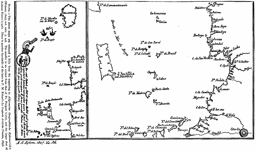
Description: Two facsimiles of early maps of the west coast of Europe showing the Atlantic islands off the coast of Spain and North Africa. The left–hand facsimile is of the Fr. Pizigani map (1367), illustrating an early Irish monk voyage, and shows the Azores, Cadiz Spain, the Strait of Gibraltar, Cape Finisterre, and Ireland. The right–hand facsimile is of the Andreas Bianco map (1436), showing the Cape Verde Islands, Canary Islands, Cadiz Spain, Gibraltar, and north to Cape Finisterre.
Place Names: Miscellaneous Europe, Portugal, �Irelan
ISO Topic Categories: location,
inlandWaters,
oceans
Keywords: West Coast of Europe, physical, kEarlyMapsFacsimile, physical features, location,
inlandWaters,
oceans, Unknown, 1367–1436
Source: Justin Winsor, Narrative and Critical History of America Vol 1 (New York, NY: Houghton, Mifflin, and Company, 1889) 54
Map Credit: Courtesy the private collection of Roy Winkelman |
|