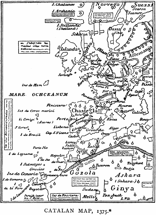
Description: A facsimile map of Europe and northwestern Africa from the Catalan Mappemonde (Atlas) of 1375.The original map is oriented to the south (which is why the flags denoting political allegiances appear to be upside down) but the facsimile and its labels are oriented to the north. European territories include Norvega (Norway), Suessif (Sweden), Schocia (Scotland), Irlanda (Ireland), Ingilterra (England), Dansia (Denmark), Allemania (Germany), and Chastela (Spain).
Place Names: Miscellaneous Europe, Portugal, �Spain, �Ireland, �Englan
ISO Topic Categories: location,
inlandWaters,
oceans
Keywords: Catalan Map, physical, kEarlyMapsFacsimile, physical features, location,
inlandWaters,
oceans, Unknown, 1375
Source: Justin Winsor, Narrative and Critical History of America Vol 1 (New York, NY: Houghton, Mifflin, and Company, 1889) 55
Map Credit: Courtesy the private collection of Roy Winkelman |
|