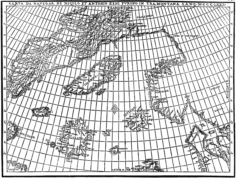
Description: A facsimile of the Zeno map of the purported voyage of Nicolo and Antonio Zeno across the North Atlantic to North America in 1380 (generally presumed to be a hoax intended to claim discovery of the New World before Columbus). The map shows Norvegia (Norway), Denmark, Iceland, Greenland, and the fictitious Frisland.
Place Names: Miscellaneous Europe, Iceland, �Norwa
ISO Topic Categories: oceans,
location,
inlandWaters
Keywords: Zeno Map, physical, kEarlyMapsFacsimile, physical features, oceans,
location,
inlandWaters, Unknown, 1558
Source: Justin Winsor, Narrative and Critical History of America Vol 1 (New York, NY: Houghton, Mifflin, and Company, 1889) 127
Map Credit: Courtesy the private collection of Roy Winkelman |
|