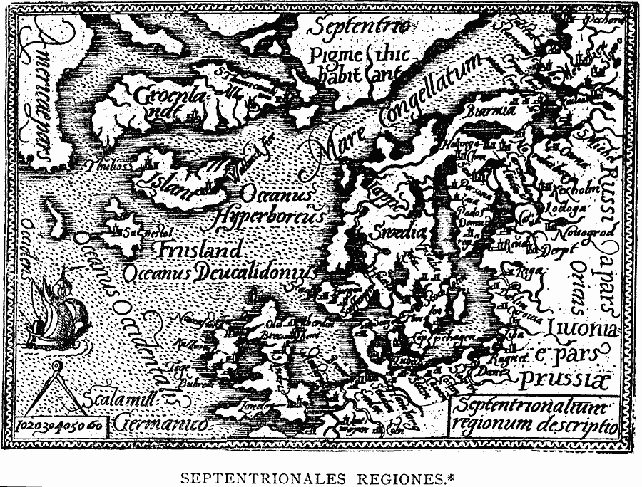
Description: A facsimile of a 1585 map of Western Europe and the North Atlantic, showing America on the eastern side, and includes the British Isles (London near bottom of map), Denmark, Sweden, Norway, and the western portion of Russia. As noted in the text, Groenlandt (Greenland) is oriented east–west, and is shown as an island slightly larger than Islandt (Iceland).
Place Names: Regional Atlantic Ocean, Europe, �North Americ
ISO Topic Categories: physical, kEarlyMapsFacsimile, kWorldAtlantic
Keywords: Septentrionales Regiones, physical, kEarlyMapsFacsimile, physical features, physical, kEarlyMapsFacsimile, kWorldAtlantic, Unknown, 1585
Source: Justin Winsor, Narrative and Critical History of America Vol 1 (New York, NY: Houghton, Mifflin, and Company, 1889) 129
Map Credit: Courtesy the private collection of Roy Winkelman |
|