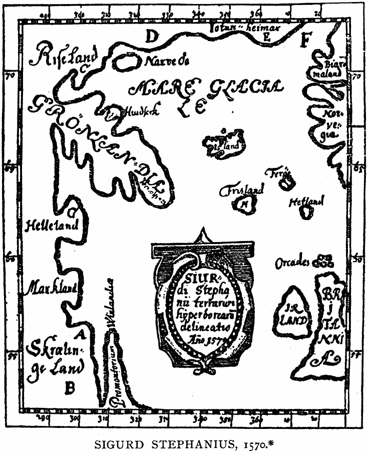
Description: A facsimile of a 1570 North Atlantic map from the Icelandic geographer Sigurd Stephanius, showing part of western Norway (Norvegia), Britain (Britannia), Ireland (Ir Land), Orkney Islands (Orcades), Shetland Islands (Hetland), Faroe (Fero), Iceland, and Greenland (Grönlandia). On the map, Helluland, Markland, Skraeling's Land, and the promontory of Vineland are shown as part of Greenland.
Place Names: Regional Atlantic Ocean, Europe, �North America, �Britain, �Irelan
ISO Topic Categories: physical, kEarlyMapsFacsimile, kWorldAtlantic
Keywords: Sigurd Stephanius Map, physical, kEarlyMapsFacsimile, physical features, physical, kEarlyMapsFacsimile, kWorldAtlantic, Unknown, 1570
Source: Justin Winsor, Narrative and Critical History of America Vol 1 (New York, NY: Houghton, Mifflin, and Company, 1889) 130
Map Credit: Courtesy the private collection of Roy Winkelman |
|