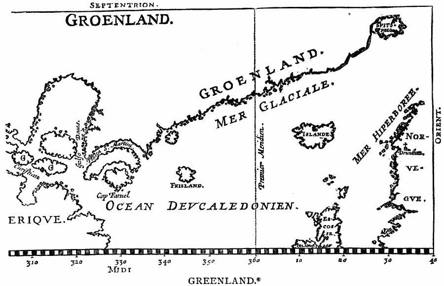
Description: A facsimile of the Isaac de la Peyrère map (1647), showing the eastern coast of Greenland, Islande (Iceland), Norvegve (Norway), and Escotse (Scotland). The Prime Meridian longitude is shown further west than the Greenwich Prime Meridian.
Place Names: Denmark, Greenland, �Groenlan
ISO Topic Categories: oceans,
location
Keywords: Greenland, physical, kEarlyMapsFacsimile, physical features, oceans,
location, Unknown, 1647
Source: Justin Winsor, Narrative and Critical History of America Vol 1 (New York, NY: Houghton, Mifflin, and Company, 1889) 132
Map Credit: Courtesy the private collection of Roy Winkelman |
|