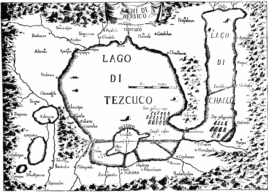
Description: A facsimile of a map by Saverio Clavigero (1780) of Tenochtitlan (Mexico City) and vicinity around the time of the Spanish conquest in 1519. This map, according to William H. Prescott (History of the Conquest of Mexico, 1876), defies "equally topography and history." The map is oriented with north to the left, and shows a fanciful shoreline of Lago di Tezcuco (Lake Texcoco) and Lago di Chalco (Lake Chalco), with the Aztec city of Tenochtitlan on the island of Messico, and neighboring cities of Tlacopan, Coatitlan, Tezcuco, and others along the shoreline.
Place Names: Mexico, Mexico Cit
ISO Topic Categories: location,
oceans,
inlandWaters,
transportation
Keywords: Mexico City and Vicinity, physical, �political, �transportation, kEarlyMapsFacsimile, physical features, local jurisdictions, roads, location,
oceans,
inlandWaters,
transportation, Unknown, 1580
Source: Justin Winsor, Narrative and Critical History of America Vol 1 (New York, NY: Houghton, Mifflin, and Company, 1889) 143
Map Credit: Courtesy the private collection of Roy Winkelman |
|